
RoutePilot covers the whole passage workflow: build the route, check the weather at every ETA, follow the ship live, report the voyage and show it to guests on board.
Route planning
Build routes directly on the chart
Each waypoint shows ETA, leg distance and bearing. Great-circle (haversine) distances are calculated for every leg, across any ocean basin.
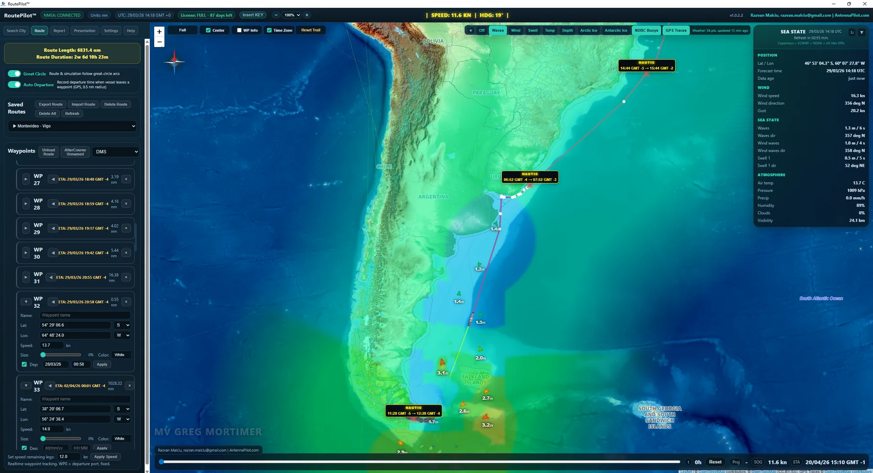
- Click to place waypoints on any base layer and zoom level; drag to reshape the route.
- Multiple saved routes: open, rename, duplicate or delete from the sidebar.
- Child waypoints: alter-course points grouped under their parent waypoint in the voyage report.
- Departure settings per waypoint: planned stops and anchorages with ETA restart.
Weather and sea state
Weather at each waypoint ETA, not at departure
Weather is fetched from Open-Meteo and matched to the ETA of each waypoint. Several models are blended: Copernicus, ECMWF, GFS, DWD ICON and Météo-France.
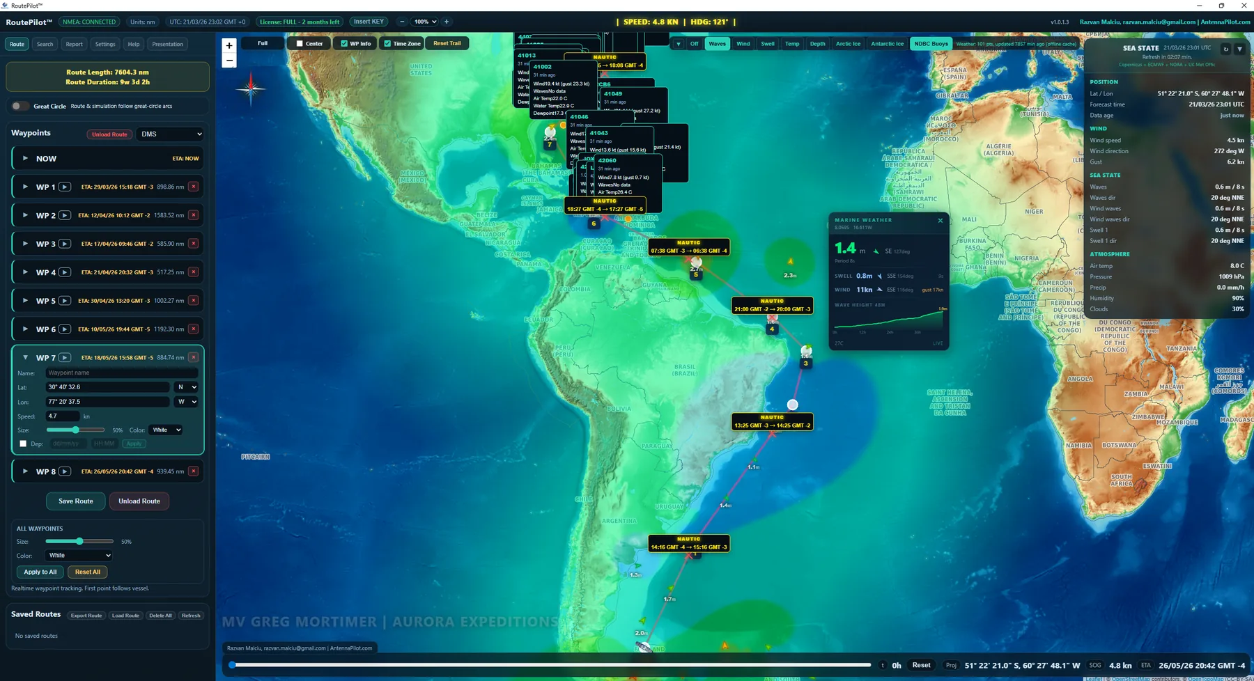
Weather overlays
- Wave height as a colour grid, green to red.
- Wind speed and direction arrows.
- Swell period and direction per waypoint.
- Sea surface temperature along the route.
- Forecast visibility in km.
- Arctic and Antarctic sea ice from NOAA satellite data.
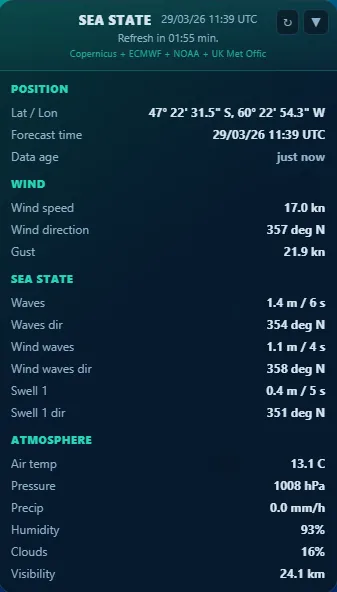
Sea state card
- Wave height, period and direction.
- Wind waves and swell separately.
- Air temperature, pressure, precipitation.
- Humidity, cloud cover, visibility.
- NOAA NDBC buoy observations.
Live position
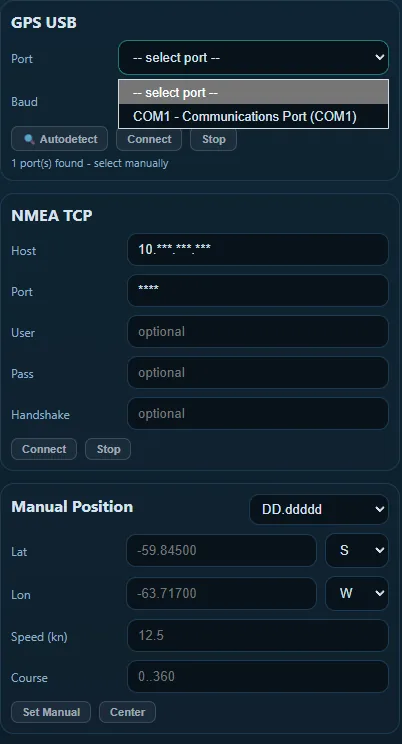
NMEA 0183 live feed
A TCP connection to the ship’s NMEA multiplexer, or a USB GPS antenna. RoutePilot reads position, speed and heading continuously: the ship icon moves on the chart and ETAs update live.
- Smoothing on speed and heading removes jitter without adding delay.
- Automatic reconnection after any network interruption.
- Automatic departure time stamps as the vessel passes each waypoint.
Reporting
Voyage report
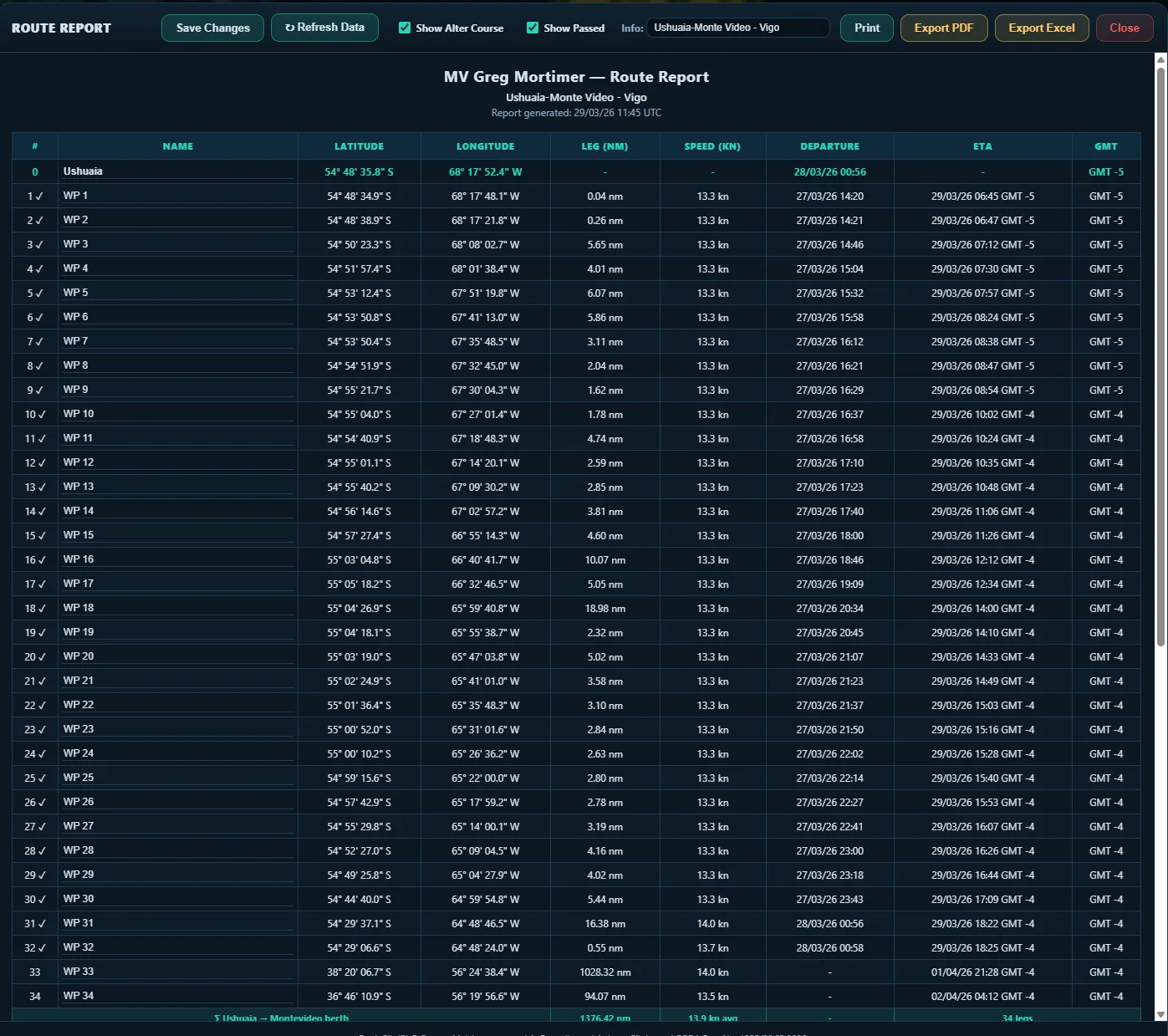
A professional passage report with all waypoints, ETAs in local time and UTC, leg distances, planned speeds, departure times and timezone offsets. Child waypoints are grouped under their parent with the combined leg distance. Print it, save it as PDF or export it to Excel.
ECDIS exchange
ECDIS import and export: RTZ, GPX, KML and more
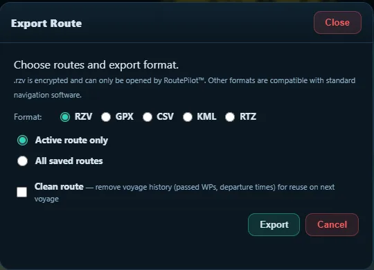
RoutePilot detects the format and the source device automatically. Supported: RTZ, GPX, KML, CSV, RT3, NACOS, JRC, MARIS, OziExplorer and more, plus RoutePilot’s own encrypted .rzv file. Compatible with Furuno, Sperry Marine, Kongsberg K-Bridge, JRC, Raytheon Anschutz, OpenCPN and MaxSea/TimeZero.
Charts
Chart layers and map providers
- OpenStreetMap: standard base map, usable offline with cached tiles.
- OpenSeaMap: nautical symbols, buoys and depth contours.
- OpenTopoMap: terrain and bathymetry, ideal for fjords and polar passages.
- Windy overlays: animated wind, waves, swell and temperature (optional API key).
- Arctic and Antarctic ice: NOAA NSIDC MODIS sea ice extent.
- NDBC buoys: live NOAA moored buoy observations on the chart.
Presentation mode
A passenger display for lounges and every cabin TV
The Presentation tab turns RoutePilot into a passenger-facing display. It runs on lounge screens, on an external HDMI display, or on every cabin TV through the ship’s IPTV map channel. Live charts with weather overlays alternate with photos and videos of the next ports, anchorages, fjords and excursions, in a continuous loop. Once set up, it runs on its own, with no bridge interaction.
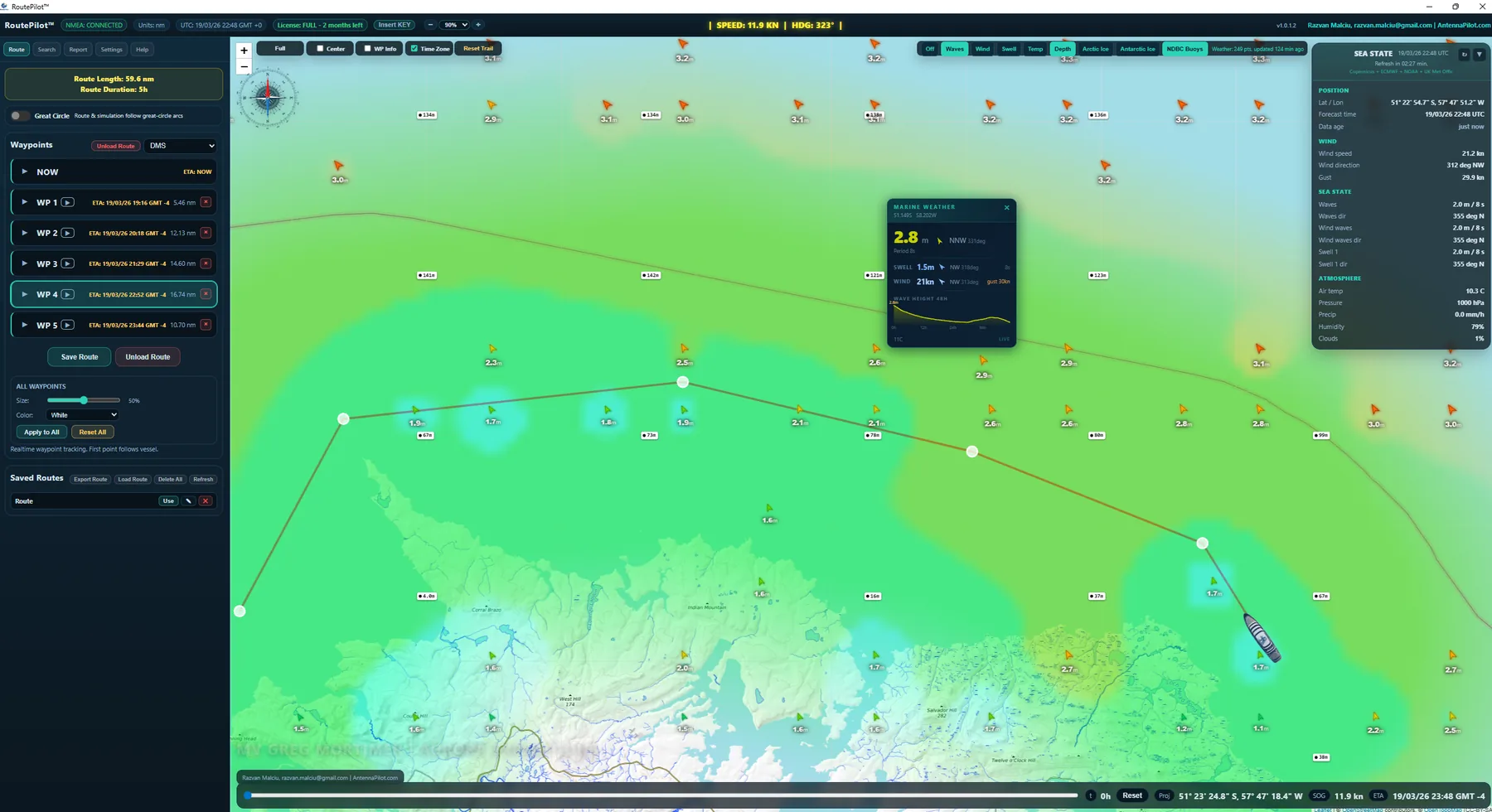
What guests see on screen
- The live chart with the vessel’s real position and heading.
- The planned route, with waypoints, legs and distances.
- Real-time ETA for the next port or waypoint.
- Live weather: wind, waves, swell, sea temperature, visibility, ice.
- The sea state card with NDBC buoy observations.
- Photo and video slides of destinations and highlights.
- An optional company logo and the vessel name, always visible.
Output and distribution
- External HDMI monitor: a fullscreen presentation window on a second screen.
- Ship IPTV: the same display as the map channel on every cabin TV.
- Two windows: the operator keeps working on the bridge view while the passenger display runs independently.
- Apply to Presentation: push the current bridge view to the TV instantly, as a one-shot snapshot.
Slides
- Map slides keep position, zoom, weather, depth, seamarks, buoys, ice and timezone labels for each slide.
- Image slides: JPG, PNG, WEBP or BMP, up to 8 MB each.
- Video slides: MP4 or WebM (H.264), up to 50 MB each, with the duration detected automatically.
- Animated GIF slides for short loops.
- Time projection slides: animated weather forecast over the next hours.
- Live tracking: any map slide can follow the ship in real time.
Slide management and playback
- Drag and drop to reorder; mix map and media slides in any order.
- A custom duration for each slide, or a global interval of 3, 5, 10, 15 or 30 seconds.
- Videos play to the end unless trimmed; one click resets a trimmed video.
- Auto start with looping playback, plus manual play, stop, next and previous.
Branding and overlays
- A transparent PNG logo in the top-left or bottom-right corner, with adjustable size (1 to 15 % of the screen) and opacity.
- Drag-and-drop placement on a 16:9 preview.
- The ship name watermark, set once in the vessel card.
- Weather, vessel, route and ETA overlays stay active during media slides where it makes sense.
Operator experience
- A card-based panel: Playback, Slides, External TV, Vessel and TV Logo.
- A resizable sidebar that remembers its width.
- RoutePilot reopens on the tab you used last.