
What it is
Everything you need for a passage, in one window
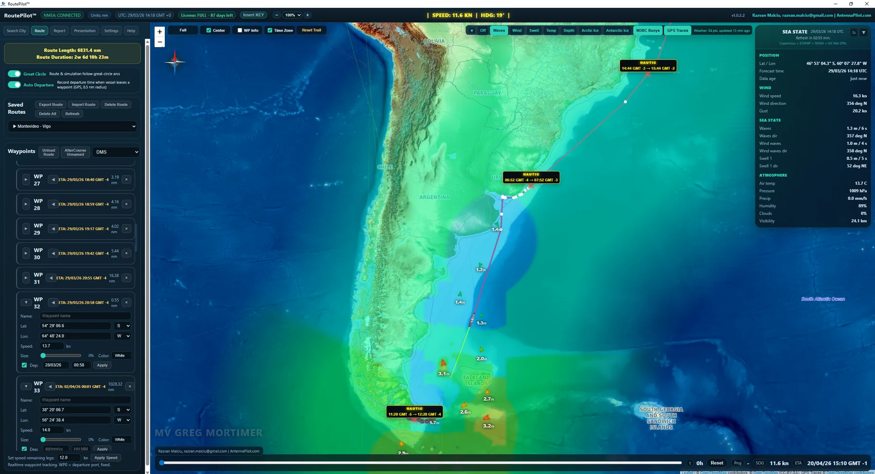
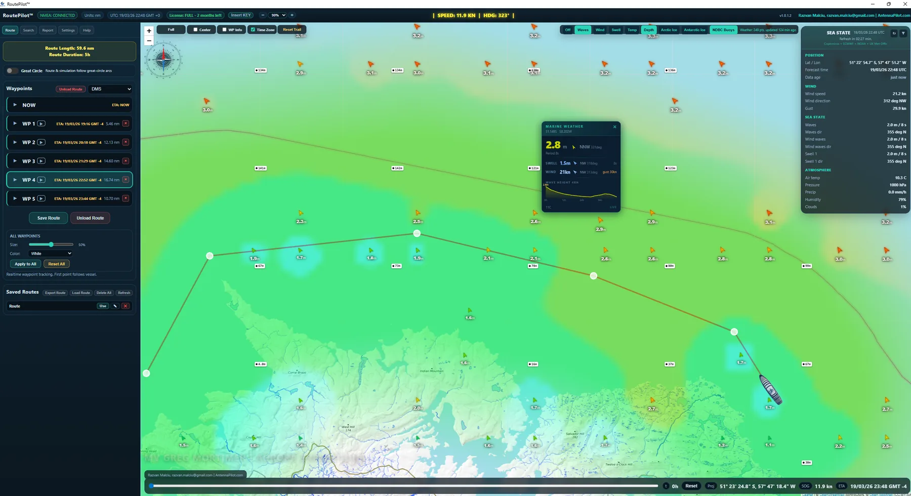
RoutePilot is a Windows application for planning and monitoring ocean passages. It combines interactive route building, weather matched to the ETA at every waypoint, live NMEA vessel tracking and real sea state data, in one interface designed for expedition and cruise vessels.
Main features
From chart to approved plan
- Interactive route builder. Click waypoints on the chart; great-circle distances are calculated for every leg. Routes are saved and reopened in seconds.
- ETA engine. Set departure time and speed, and RoutePilot gives the arrival time at every waypoint in ship’s local time and in UTC.
- Weather at your ETA. Wind, waves, swell, sea temperature and visibility for the moment you arrive at each waypoint, not for today.
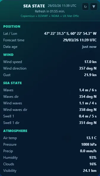
- Sea state panel. Wave height, swell period and direction, wind and gusts, pressure, per waypoint.
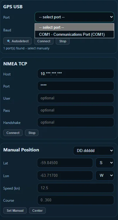
- NMEA 0183 live feed. TCP or USB connection to the ship’s NMEA source: the ship icon moves on the chart and ETAs update live.
- Voyage report. A professional passage report with all waypoints, ETAs, leg distances and time zones. Print or save as PDF.
How it works
The same sequence used on the bridge
- Build the route. Click waypoints on the chart, set speed and departure time.
- Fetch the weather. One click pulls the forecast for every waypoint, matched to its ETA.
- Connect NMEA. Enter the IP and port of the NMEA multiplexer and follow the ship live.
- Review and save. Check weather and ETAs, save the route or export it to ECDIS.
Onboard displays
Presentation mode for expedition teams: position, weather, photos and video
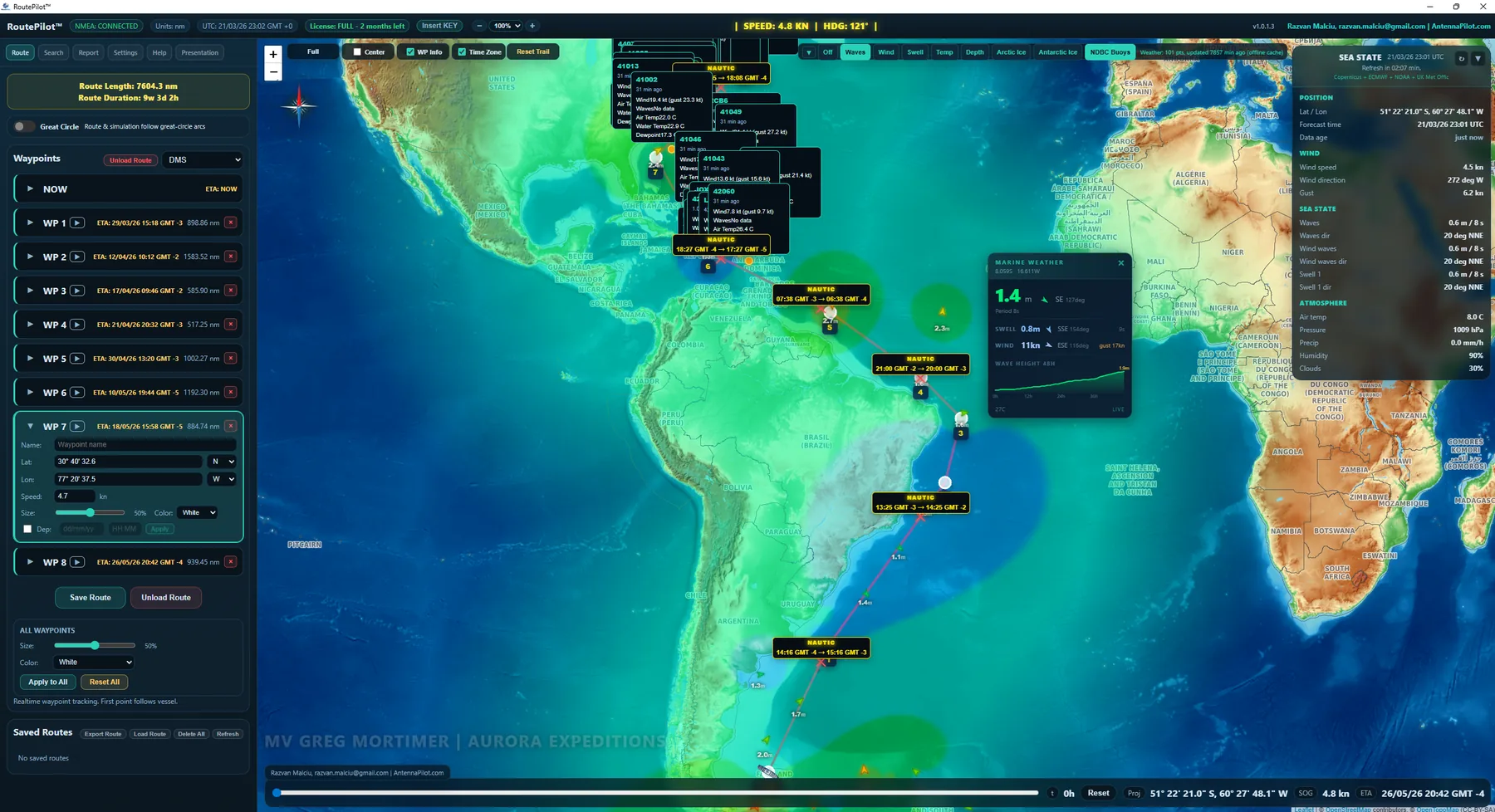
Turn the route into a passenger display: live chart, route, ETA and weather, mixed with photos and videos of the next destinations, on a lounge screen or as a channel on the ship’s IPTV. See all presentation features. For a permanent live position channel on every cabin TV, running on its own onboard server, see Wakeline.
Requirements
System requirements
| Operating system | Windows 10 / 11 (64-bit) |
| Runtime | Included |
| Browser engine | Microsoft Edge WebView2 (auto-installed if missing) |
| RAM | 4 GB minimum, 8 GB recommended |
| Storage | 200 MB for application; cache grows with tile use |
| Network | Internet for weather API and map tiles; LAN for NMEA |
| NMEA source | TCP/IP NMEA 0183 multiplexer (optional) |