
See it working
The real screens, with real data
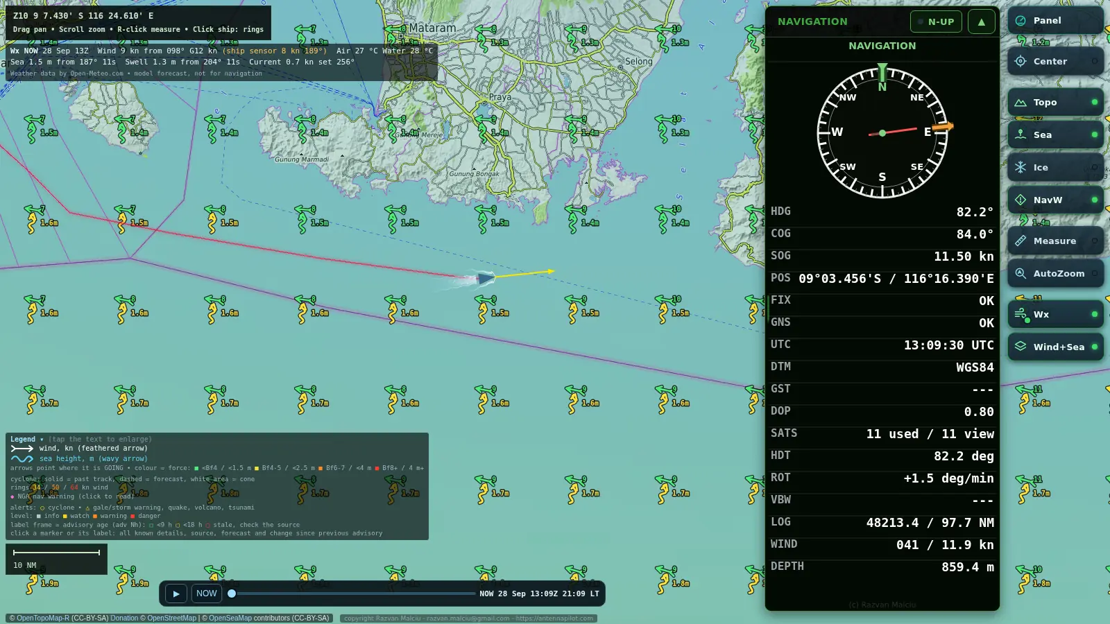
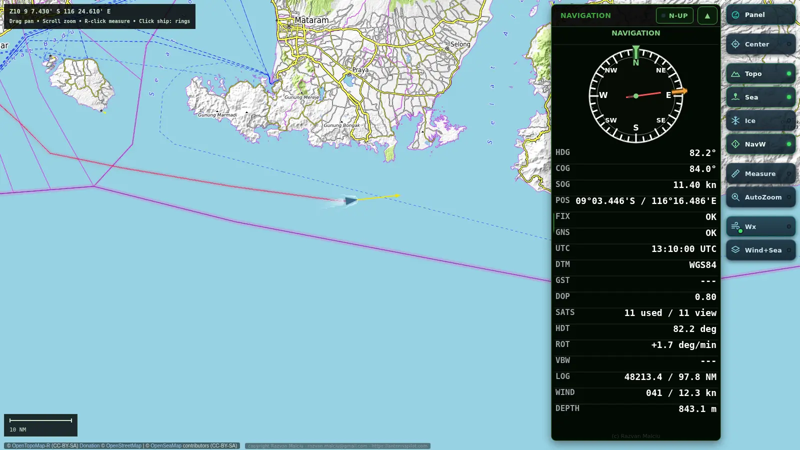
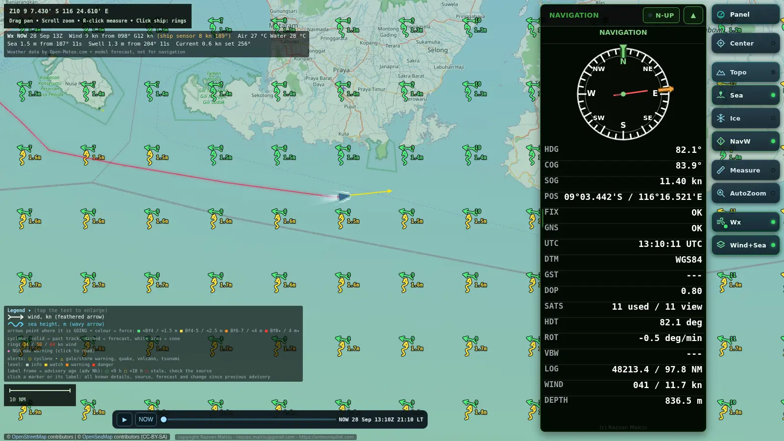
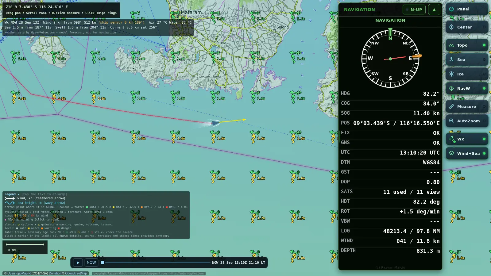
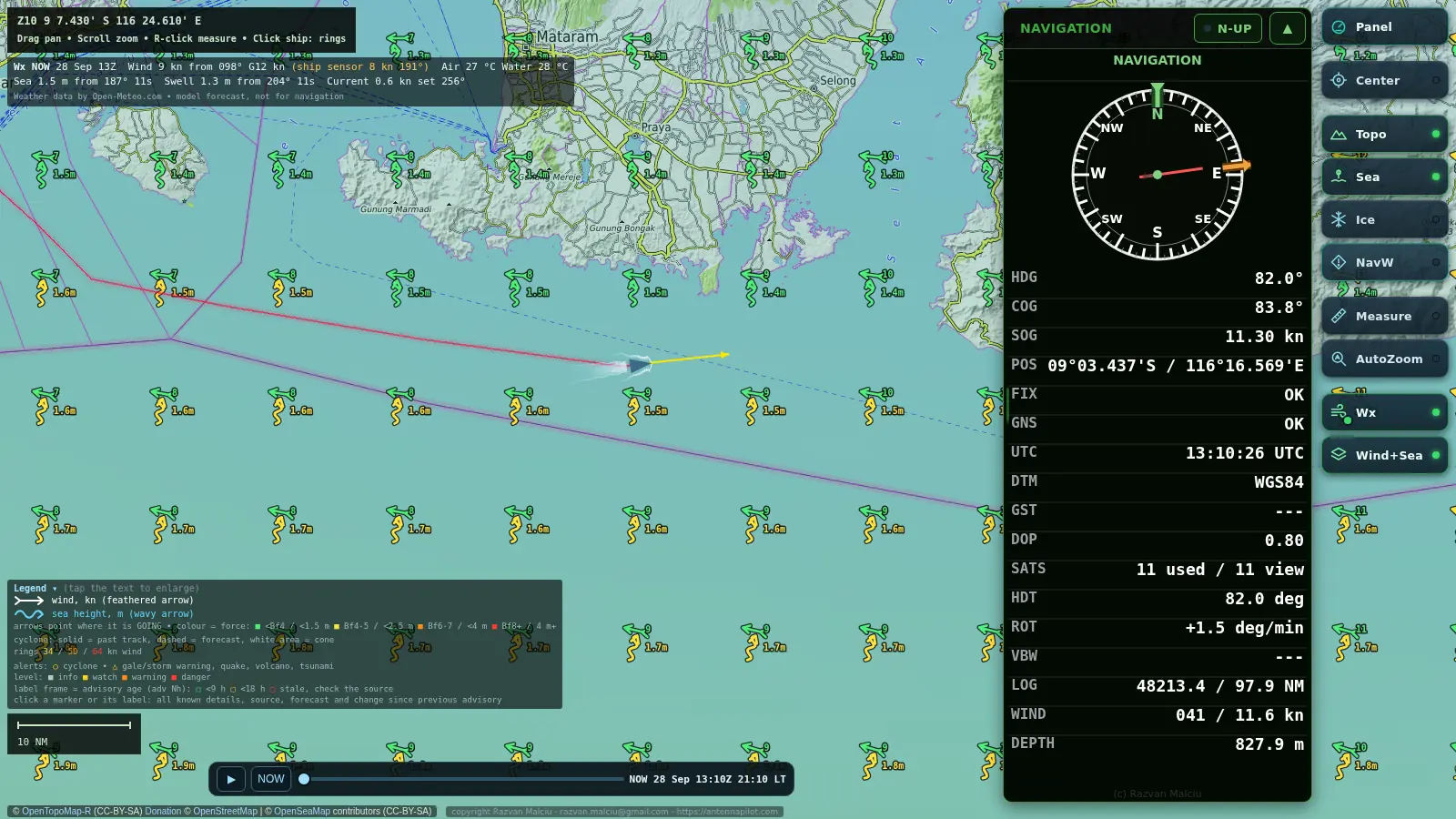
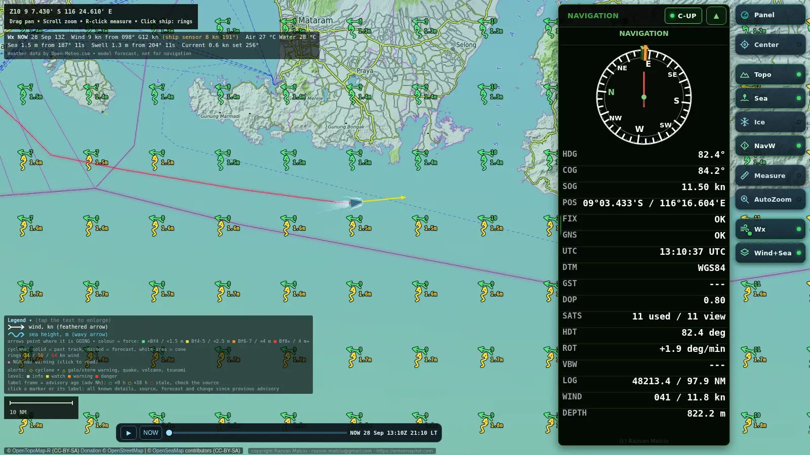
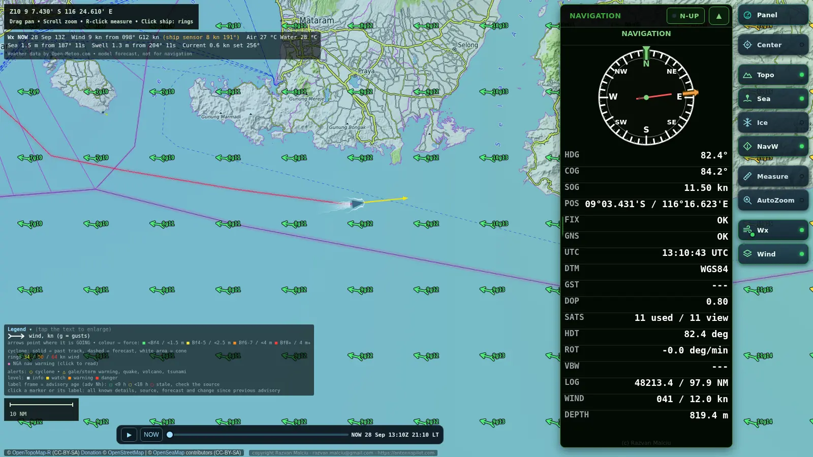
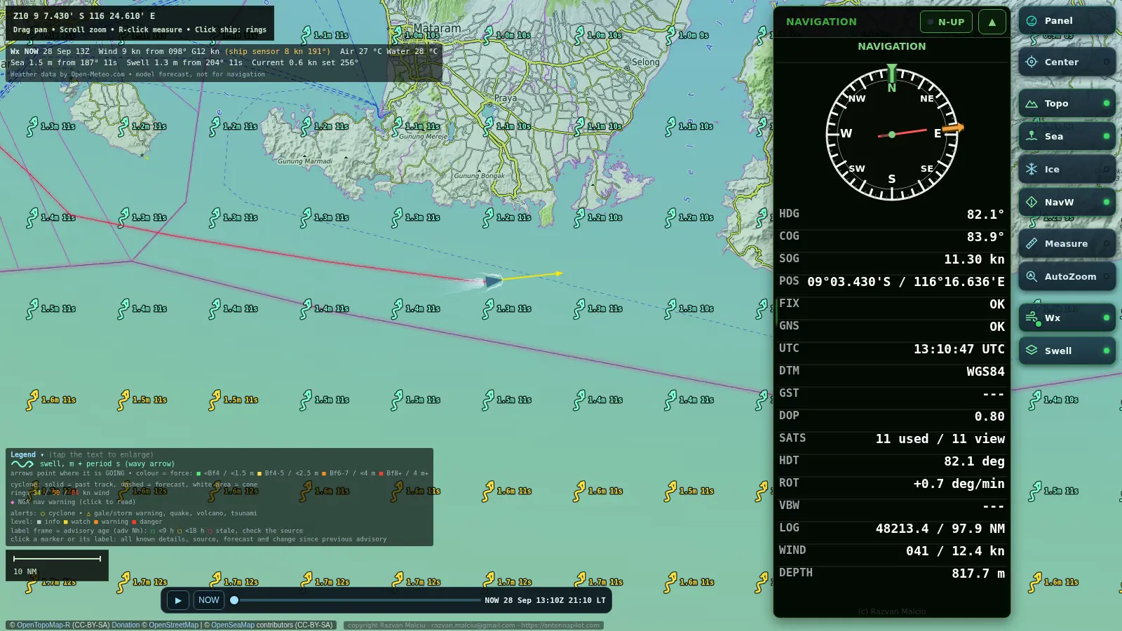
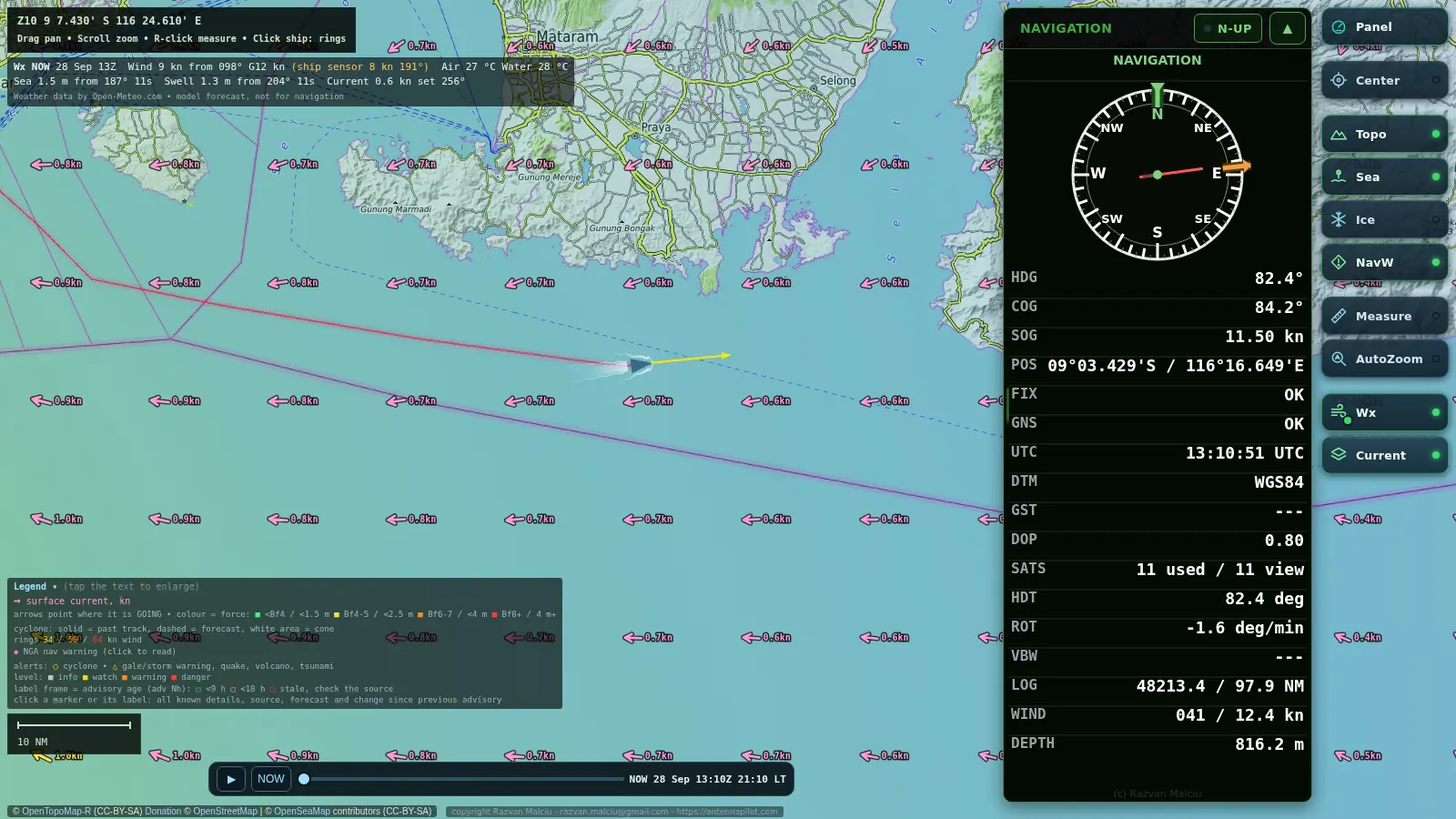
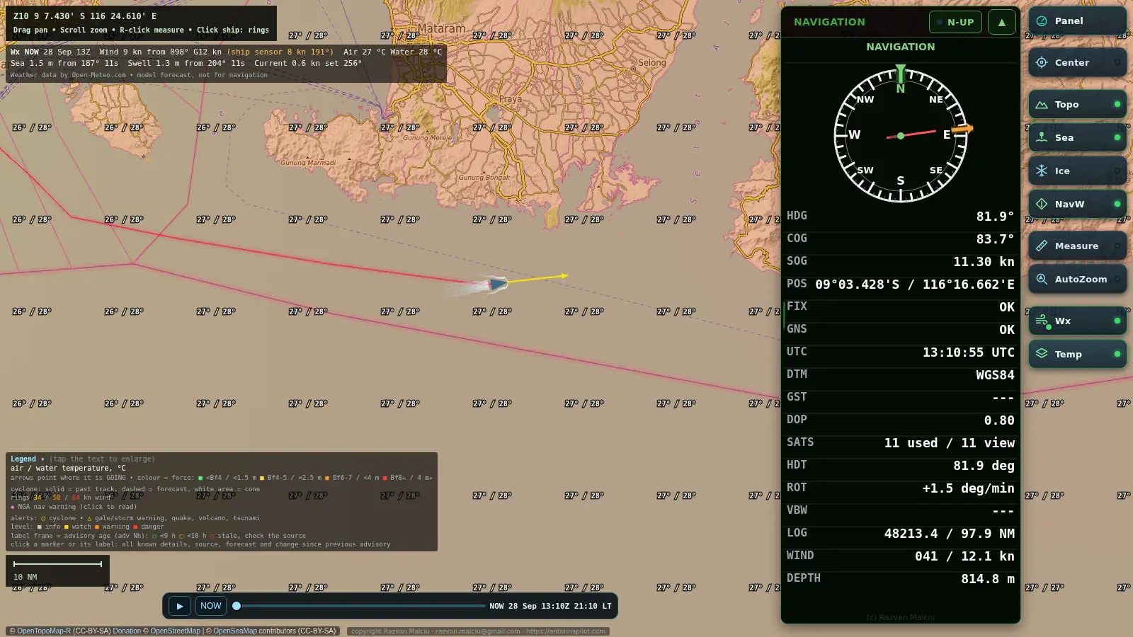
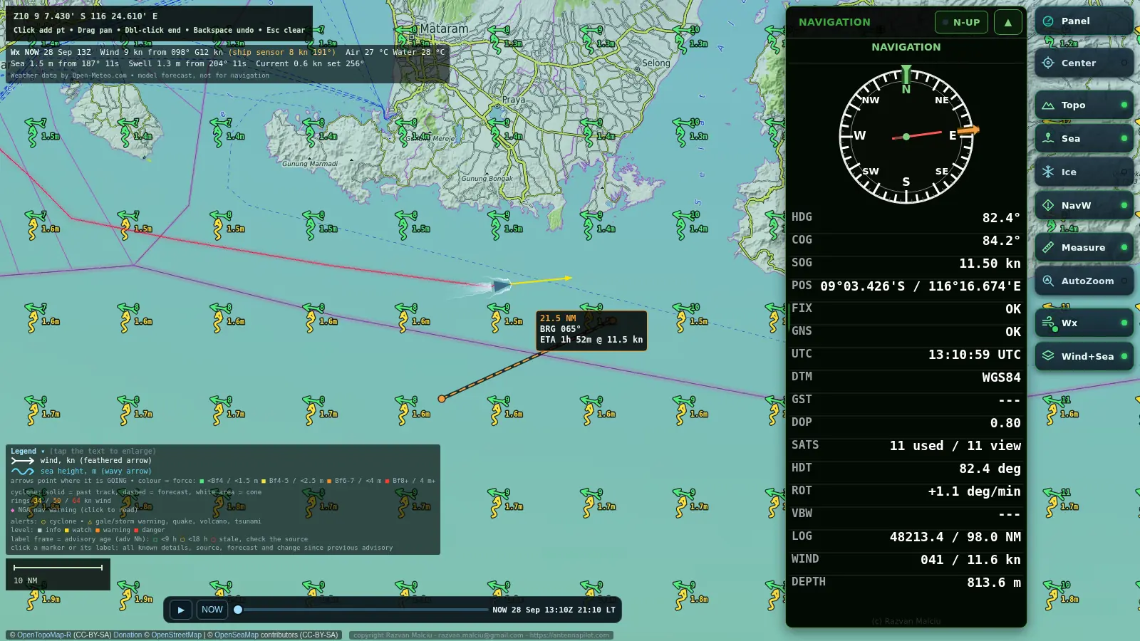
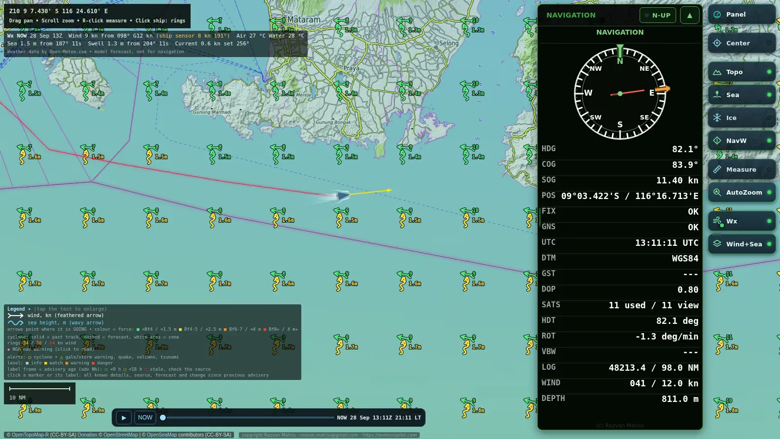
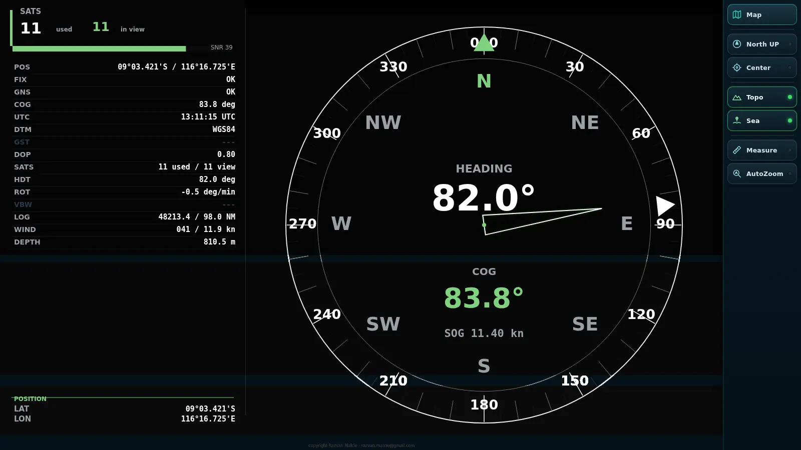
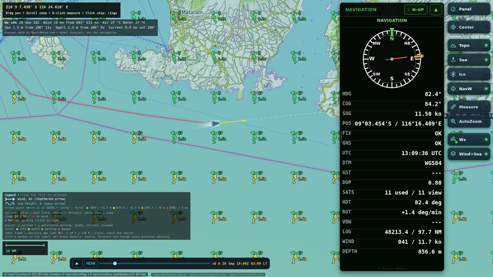
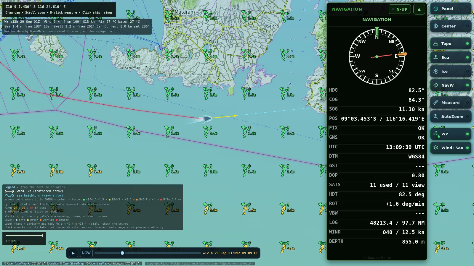
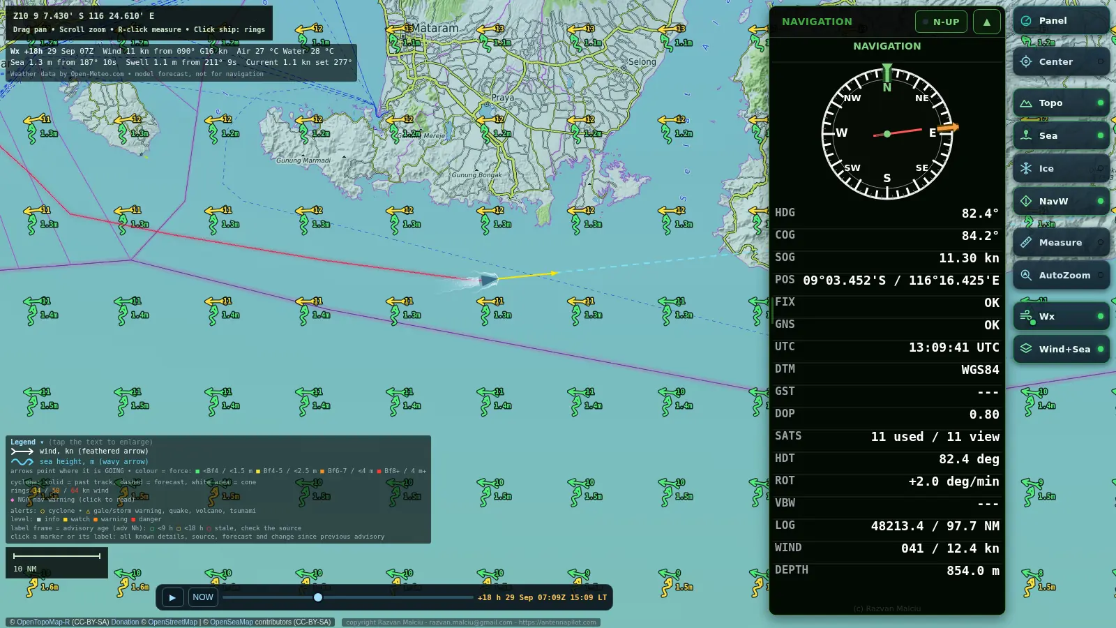
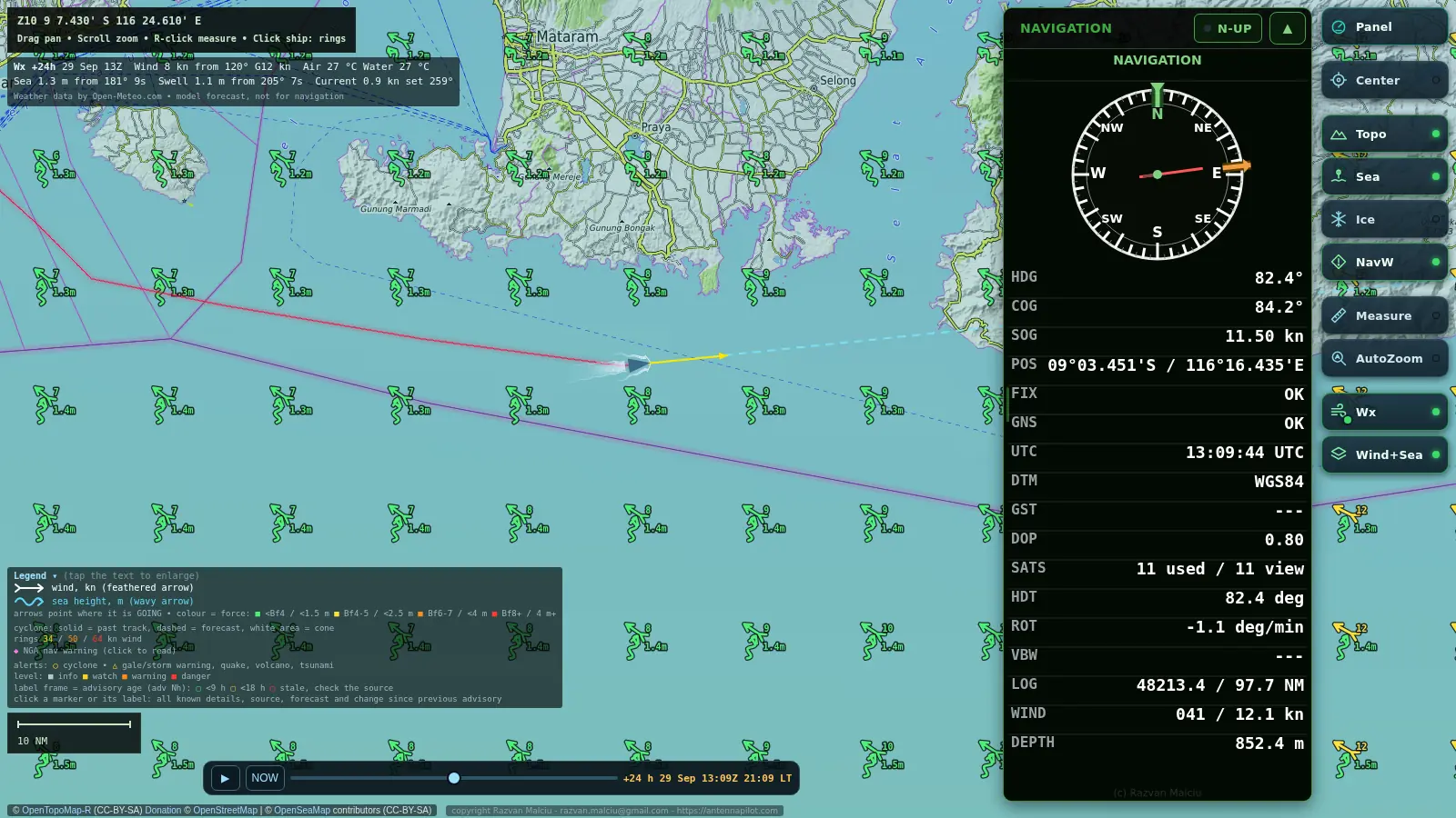
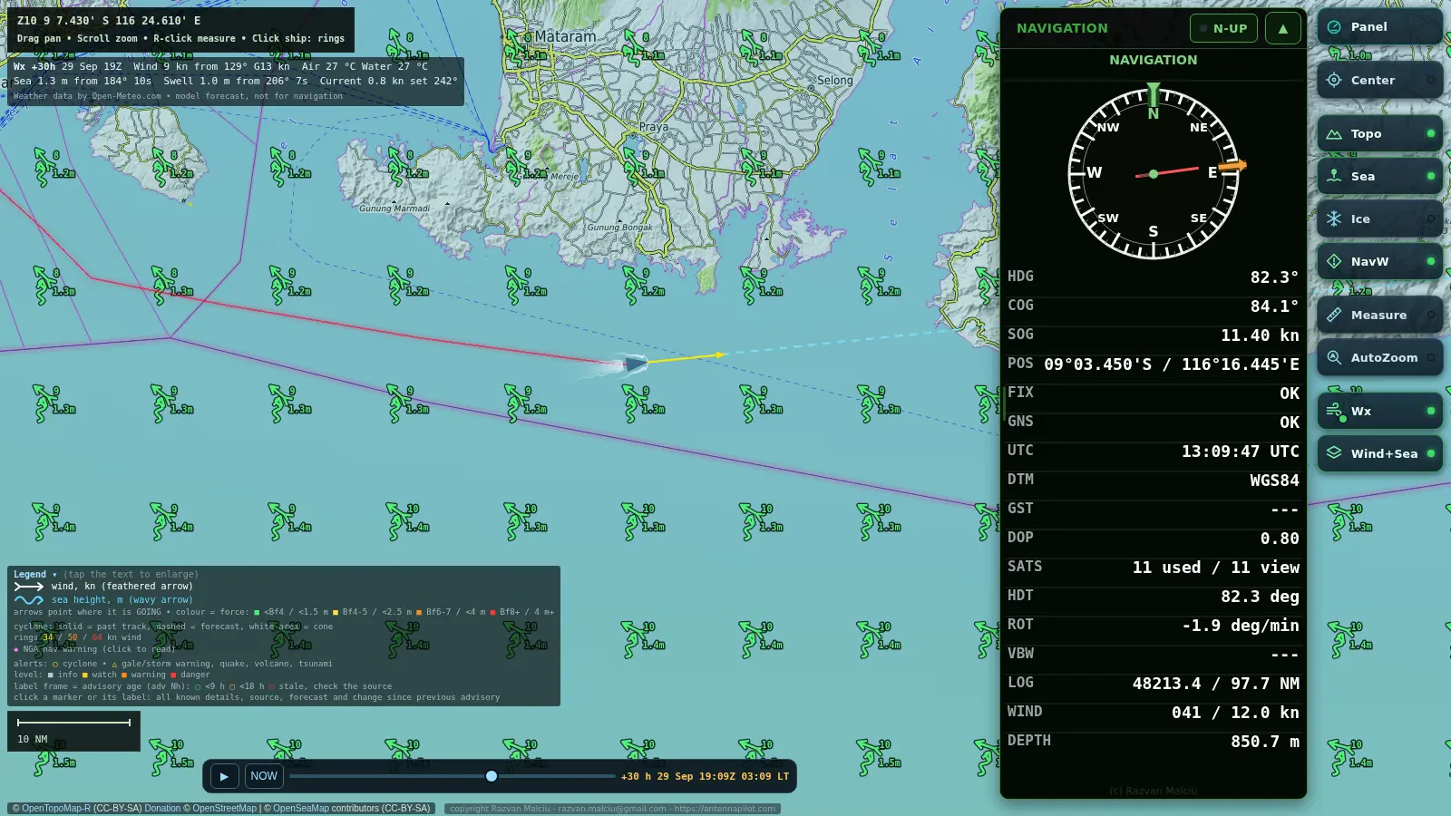
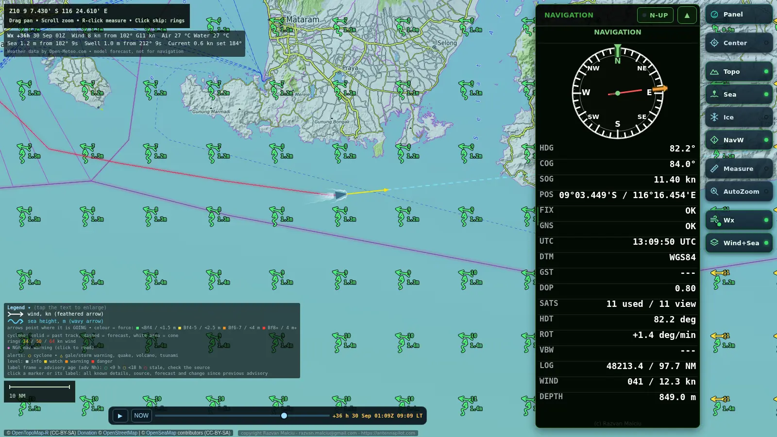
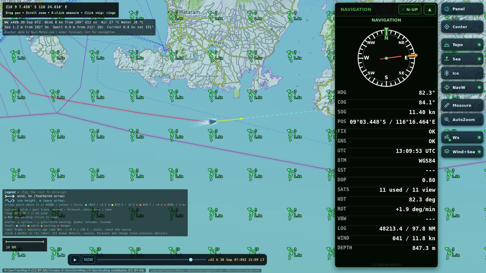
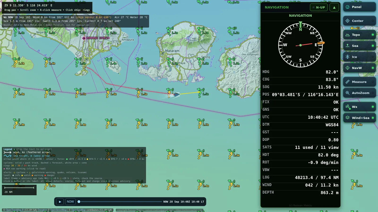
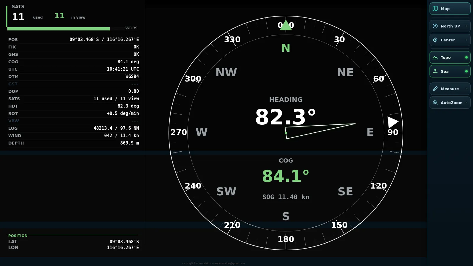
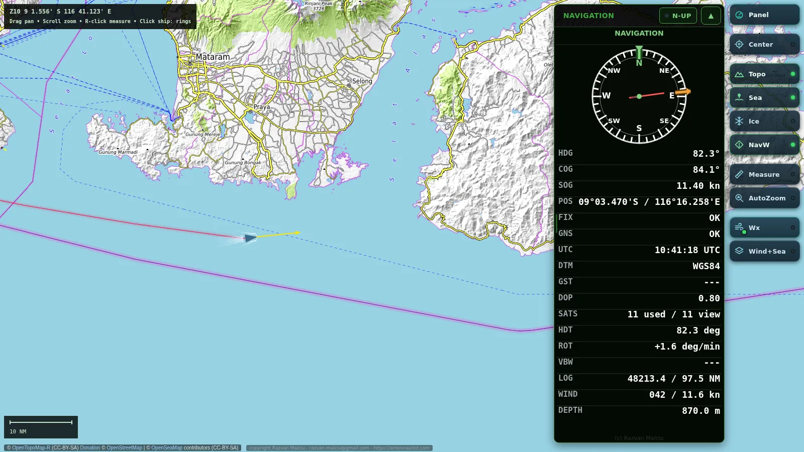
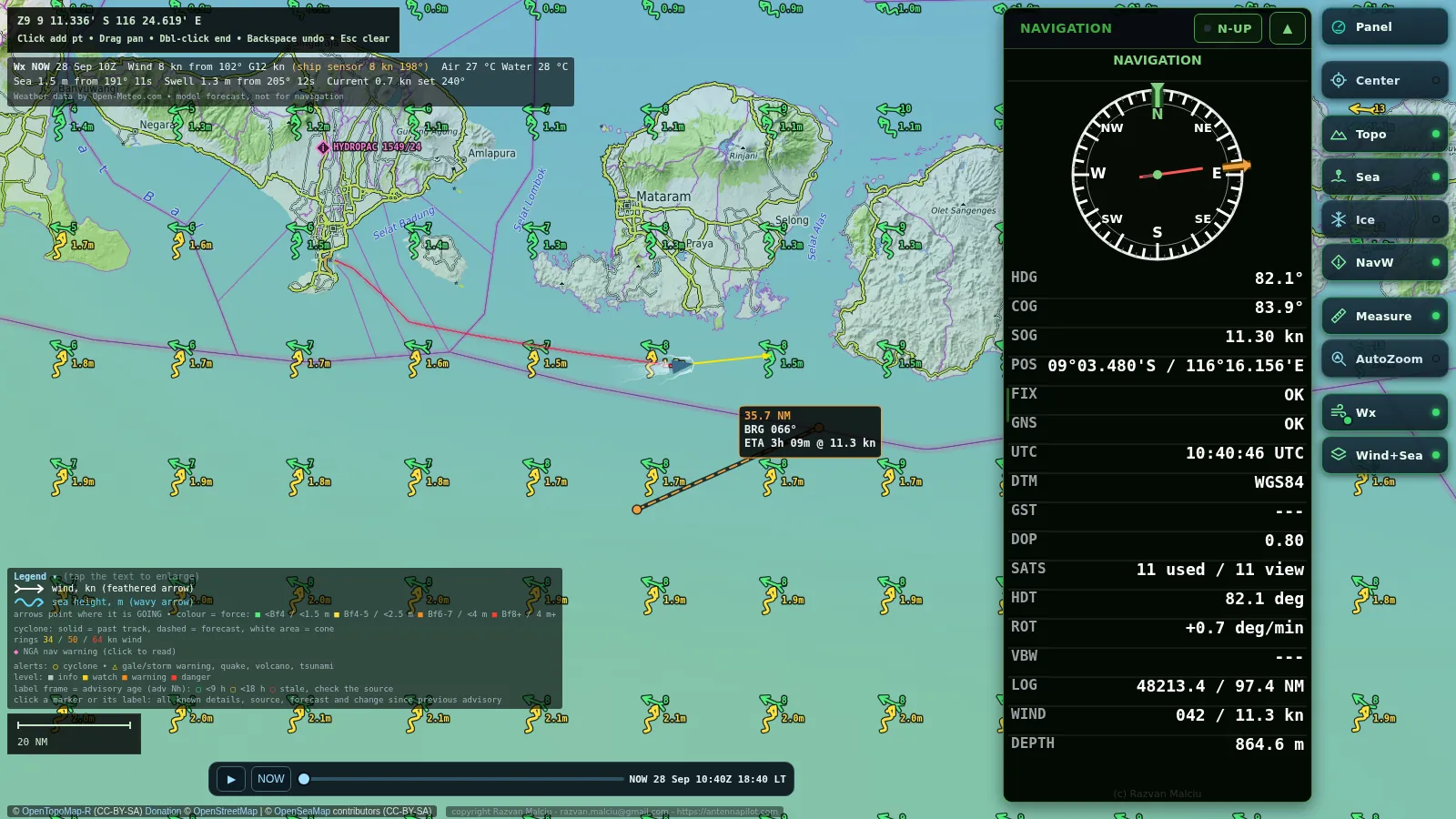
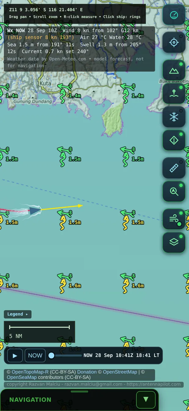
These are screenshots of Wakeline itself, taken on a test passage from Benoa, Bali, towards Lombok and Sumbawa. The position comes from an NMEA feed; weather, swell and currents are the real forecast for that morning; the navigational warning on Bali is a real NAVAREA message.
For guests
A live ship position channel on every cabin TV
Wakeline gives your IPTV system a ready-made map channel. It cycles through scenes you choose, such as the ship on the chart, the wind, or wind and sea state over the whole region, with a clear title and the ship’s position, time, speed and course at the top. Guests switch to the channel and always know where they are.
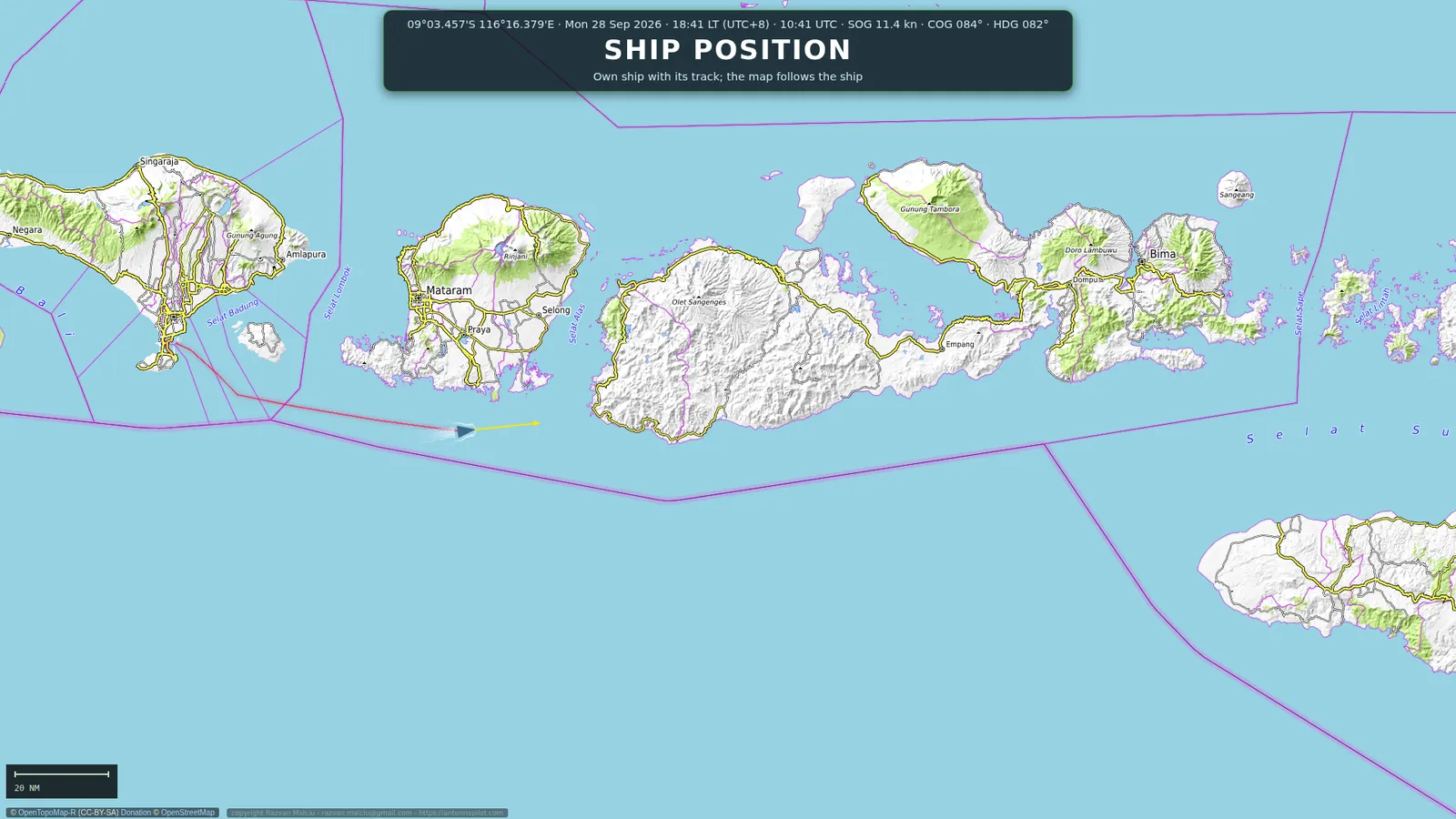
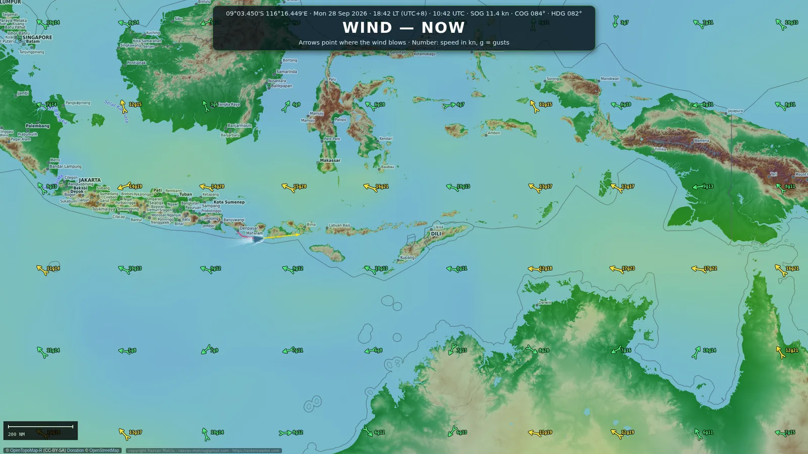
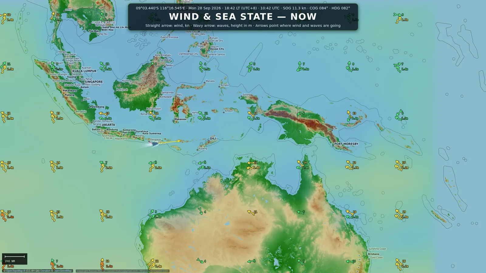
The same map runs full screen on an engine room kiosk, together with the ship’s clock, world clocks and a scrolling message you set from the office or the bridge.
Weather and alerts
Forecasts, cyclones and warnings on one chart
Wakeline collects public forecasts and official alerts and draws them where the ship will be, for the next 48 hours. A time bar plays the forecast forward, and a coloured dot on the weather button shows at a glance whether the data is current.
| Layer | What you see | Source |
|---|---|---|
| Wind, waves, swell | Arrows that grow and change colour with strength, plus currents and sea temperature | Open-Meteo global models |
| Tropical cyclones | Track, forecast cone, 34/50/64 kn wind radii, distance and bearing from the ship | NHC, JTWC, JMA, GDACS; the most recent bulletin takes priority |
| High seas storms | Gale and storm warnings near the route | NWS high seas forecasts, Bureau of Meteorology |
| Navigational warnings | NAVAREA messages as markers; tap to read | NGA Maritime Safety Information |
| Sea ice | Satellite ice layer for polar voyages | NASA satellite analysis |
| Quakes and tsunami | Strong earthquakes and tsunami messages in range | USGS, tsunami.gov |
Alert levels are set on board: for example yellow, orange and red at 34, 48 and 64 knots of wind, 4, 6 and 9 metres of waves, or a cyclone within 1000, 500 and 250 nautical miles. An alert banner shows the level and the distance; one tap acknowledges it until something new or worse appears.
Data sources
Where the data comes from, and how far to trust it
| Data | Source | Updated | How far to trust it |
|---|---|---|---|
| Position, course, speed, heading, depth, measured wind | The ship’s own navigation equipment, through the NMEA hub on the bridge | Continuously, every 1–2 s | High: these are the ship’s own data. If the network link drops, the screens may pause for a minute or two. |
| Base chart | OpenStreetMap, OpenTopoMap | On demand, kept on the server (up to about 25 GB) | For orientation only, not an official chart. Coastlines can be imprecise. |
| Seamarks | OpenSeaMap (volunteer project) | On demand | Incomplete and unofficial. |
| Wind, waves, swell, currents, temperature | Open-Meteo global numerical models | Every few hours, forecast up to +48 h | A model, not an observation: good for trends, not for exact values. |
| Tropical cyclones | NHC (USA), JTWC, JMA (Japan), GDACS (EU/UN) | With each bulletin, usually every 6 h | Official agencies and GDACS alerts. The most recent bulletin is used; between sources the order is NHC, JTWC, JMA, GDACS. |
| High seas storm warnings | NWS High Seas Forecasts (OPC, NHC, Honolulu), Bureau of Meteorology Australia | About every 6 h, within 1,500 NM of the ship | Official. |
| Navigational warnings | NGA Maritime Safety Information, NAVAREA | Periodically | Official, but always check the official channels as well (NAVTEX, SafetyNET). |
| Sea ice | NASA GHRSST MUR (satellite) | Daily | For orientation, resolution about 1 km. |
| Earthquakes, tsunami | USGS, tsunami.gov | Periodically | Official. |
All sources are free and public. Everything is downloaded over the ship’s satellite link with a daily limit, so Wakeline keeps satellite bandwidth use to a minimum. If a source does not answer, the last version received is kept, and a coloured dot on the Wx button shows the state of the data: green for current, yellow for old, red for missing.
Ship’s time
Accurate time for the whole network, from the ship’s own GPS
The Wakeline server is also the time server of the ship. It reads the time from the NMEA data of the GPS already on the bridge and shares it over NTP, keeping PCs, switches, firewalls and cameras synchronised to within a fraction of a second, even when the internet is down. When the ship changes time zone, the local time on every Wakeline screen and on the kiosk clock follows.
Satellite traffic
Designed for a satellite link
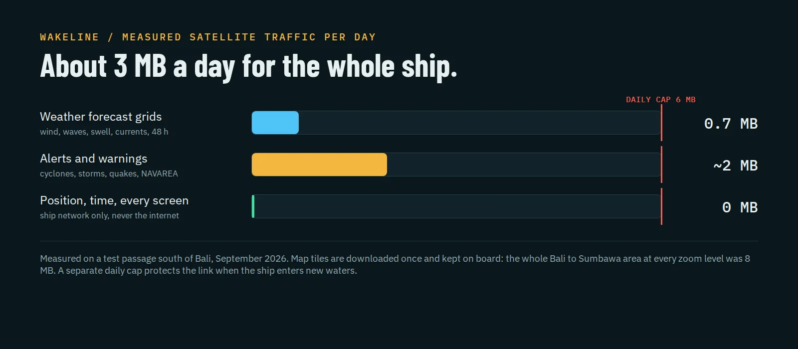
- The screens cost nothing. Crew PCs, phones, the kiosk and every cabin TV read from the Wakeline server on the ship’s network. Two hundred TVs use essentially the same satellite traffic as one.
- Weather is compact. Forecasts are fetched as a coarse grid around the ship a few times a day, compressed.
- Charts are downloaded once. Map tiles stay on board. A whole cruising area at every zoom level is a few megabytes, and a daily cap protects the link when the ship enters new waters.
- Hard limits. If a daily limit is ever reached, Wakeline keeps working with the data it already has and refreshes the next day.
Reliability
It looks after itself
Wakeline is built to run for months without anyone touching it. Several independent watchdogs check the navigation feed, the network link, the application and the hardware. If something stops, it is restarted automatically, step by step, from the lightest fix to a full restart. Old logs and unused charts are cleaned up every night, so the disk never fills.
- The navigation feed reconnects on its own after an interruption.
- The wireless link is repaired automatically if it drops.
- A frozen application or system is restarted without human help.
- The time server reconnects to the GPS feed by itself after an interruption.
- Every event is logged, and a PDF status report can be generated from the admin page.
Admin
One admin page for everything
A password-protected admin page shows the state of the navigation feed, the hub and its clients, disk usage and the latest events. From there you change the vessel name and size, the coordinate format, the weather sources and alert levels, the TV channel scenes and the kiosk message. Changes reach every screen within seconds, without a restart.
What you get
Delivered ready to run
- NMEA hub. Reads your existing NMEA 0183 source on the bridge and shares clean data with the Wakeline server. If you do not have one, a Debian-based hub is supplied with the system.
- Wakeline server. A compact Debian Linux server for the rack: chart, weather, alerts, admin page, TV channel and ship’s time.
- Optional kiosk. A permanent screen for the engine room or the crew mess.
- Configured for your ship. Network, NMEA source, vessel details and TV channel prepared and tested before delivery, with support during commissioning.
Built at sea
In service on an expedition cruise vessel
Wakeline was designed by a shipboard IT officer and runs on board an expedition cruise vessel, from the tropics to Antarctica. Every feature on this page exists because someone on board needed it.
For information only. Wakeline is not type-approved navigation equipment and not an ECDIS. Weather comes from numerical models and public feeds and does not replace the official bulletins received on board.
Wakeline is original software developed and owned by Razvan Malciu. All rights reserved. Map data © OpenStreetMap contributors, OpenTopoMap, OpenSeaMap. Weather data by Open-Meteo.com.