
What it is
A second opinion for your antenna, running beside the ACU.
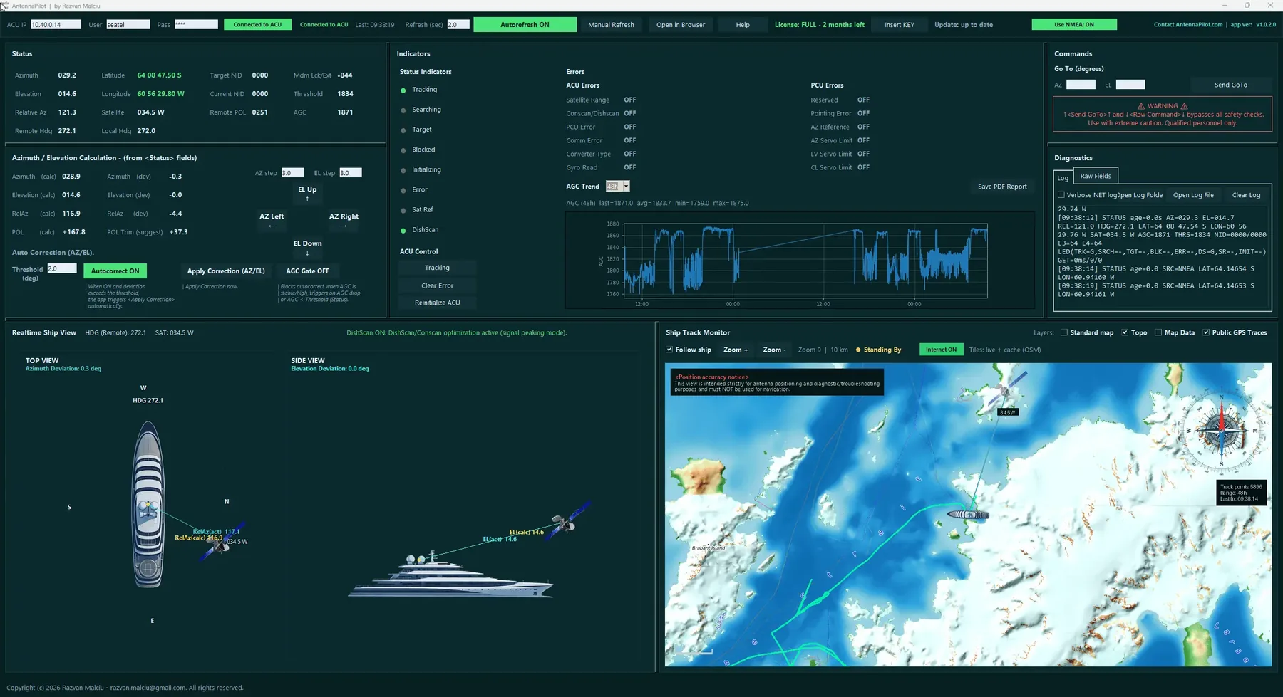
AntennaPilot is Windows software for the people who look after TVRO antennas on board. It reads the live status of the SeaTel antenna control unit over the ship’s network, calculates on its own where the antenna should be pointing, and shows both side by side. When they disagree by more than you allow, it can put the antenna back on the right satellite by itself.
Why AntennaPilot
Keeps the antenna on the right satellite, whatever happens
- Independent calculation. Azimuth, elevation, relative azimuth and polarization are computed from the ship’s position and heading, not copied from the ACU.
- Automatic re-pointing. When the deviation passes your threshold, the antenna is sent back to the calculated position and tracking resumes, each step confirmed with the ACU.
- Right satellite, not just any signal. Target NID and current NID are shown side by side, so a lock on the wrong satellite is obvious.
- Evidence for every event. An AGC trend graph, a detailed log and a PDF report for handovers and service calls.
Where it matters most
Why a ship's TV antenna loses the satellite: blockage, shadow zones and high latitudes
A stabilized TVRO antenna tracks by watching its signal level (AGC). When the level falls below the tracking threshold, for example behind a bridge, a quay crane, a tall building, the ship’s own mast or funnel, the antenna control unit waits a short delay and then starts a search pattern to find the signal again. Far north and far south the same happens more often: geostationary satellites sit low on the horizon, and a low elevation angle means more blockage.
Searching moves the antenna away from where the satellite actually is. When the obstruction clears, the antenna may still be searching somewhere else, and TV channels stay off for minutes. If satellite identification (NID) is not set or not unique, the ACU can even settle on another satellite that happens to give a signal above the threshold.
What AntennaPilot does about it
- It calculates, every two seconds, exactly where the selected satellite is from the ship’s position and heading.
- It compares that with where the ACU reports the antenna is pointing.
- When the difference in azimuth or elevation passes the threshold you set, it sends the antenna back to the calculated position, then turns tracking on again, confirming each step with the ACU.
- If the signal is still blocked and the ACU starts searching again, AntennaPilot brings the antenna back again.
The result: the moment the ship leaves the shadow zone, or the satellite rises above the obstruction, the antenna is already pointed at the right satellite. Tracking picks up the signal straight away, without a long search and without a technician retargeting the antenna by hand.
River cruises
Satellite TV antenna control for river cruise ships and beyond
On rivers the antenna meets a bridge, a lock, a bank of trees or a row of buildings every few minutes, and the crew is small, often with nobody whose job is the TV system. AntennaPilot runs on any Windows PC on board and does the watching: after every obstruction the antenna is already waiting on the right satellite, so guests get their channels back as soon as the view is clear.
See it working
Watch it on a SeaTel DAC 2202
A real session: the independent AZ/EL calculation, automatic correction, the map and the event log.
Operator in control
AutoCorrect with a threshold you set
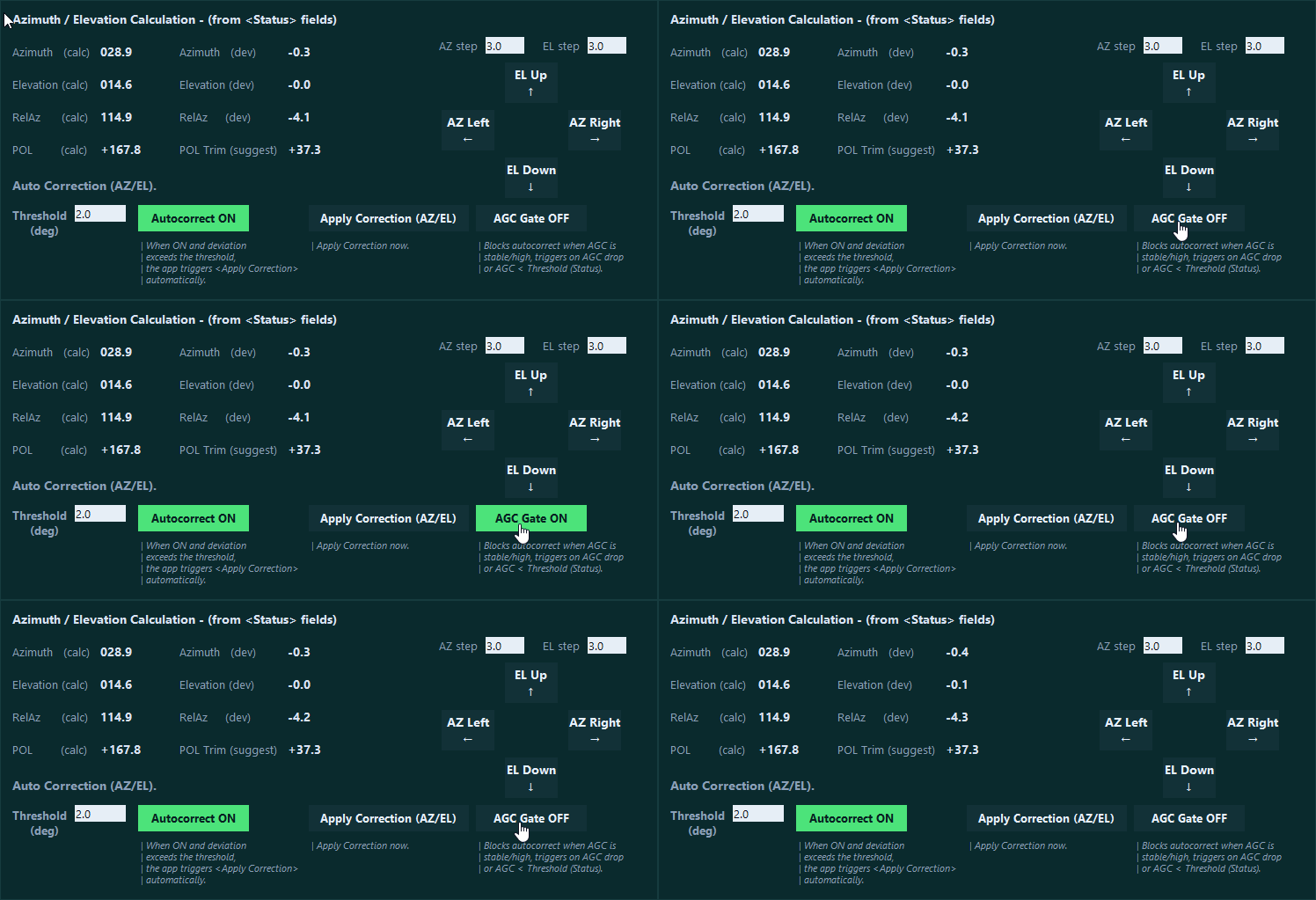
You choose the threshold in degrees (5° by default) and switch AutoCorrect on or off with one button. Corrections are rate limited, never sent while a previous one is still running, and each step is confirmed with the ACU before the next. For fine work there are manual azimuth and elevation steps of 0.1°, a polarization trim suggestion and a Clear Error command.
Context
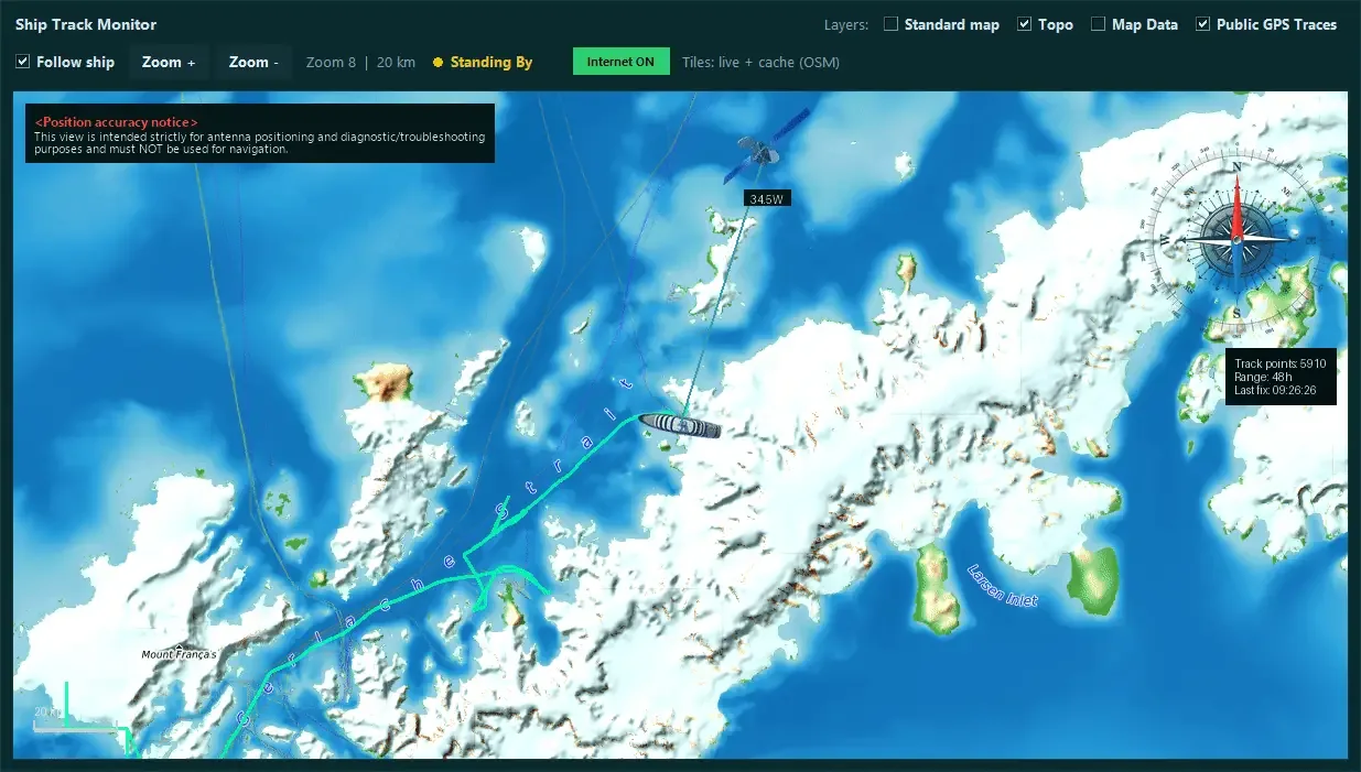
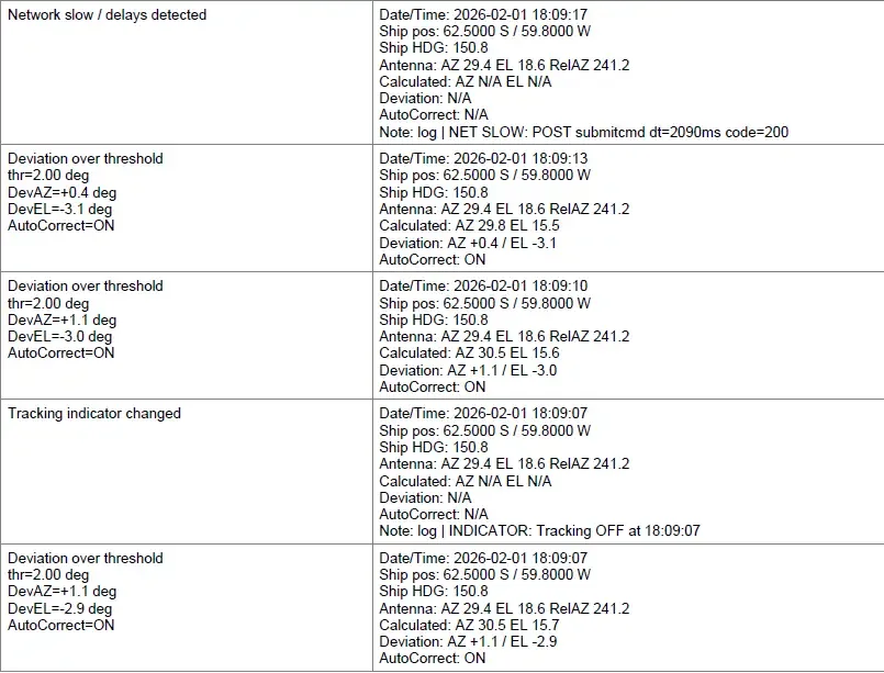
Map view and diagnostic trail
Compatibility
Built on real hardware
- Developed and tested on SeaTel (Cobham) DAC 2202 antenna control units.
- Connects to the ACU over the ship’s network, through the ACU’s own web interface.
- Windows 10 and 11. A 1920 x 1080 display or larger is recommended.
Try it for 24 hours. One installer for the demo and the full licence. Need more time to test? A demo extension key is available on request.
AntennaPilot is independent software, not affiliated with or endorsed by any antenna manufacturer. It is a diagnostic and operational support tool, not for navigation or safety-of-life decisions. AntennaPilot is registered with ORDA, the Romanian Copyright Office, under No. 1224 of 20 March 2026.